Our day trip from Las Vegas – exploring Death Valley National Park

When considering destinations for romantic getaways, most people would probably not put Death Valley National Park very high up on the list. But for us, this arid stretch of California wilderness was the perfect place to explore as a couple. With very little in the way of internet service or cell phone connections, we spent a full day wandering around strange new landscapes in blessed isolation. The views were varied and breathtaking, and the journey from our weekend base camp back in Las Vegas was short and easy. Day trip perfection!
We started out early from our hotel on the strip in Las Vegas. After grabbing a quick bite for breakfast and stocking our rental car with plenty of water and snacks, we hit the road. The drive took us a little over two hours and we spent most of the journey on main roads winding through scenic canyons, small desert towns, and the occasional larger settlement. For the most part, I would say the route was off the beaten track.

Don’t expect a ton of fast food restaurants or gas stations along the way, and be sure to fill up on gas before you arrive at the park. Pahrump, Nevada was the last town we saw before getting to Death Valley Junction. While gas is available within the park it is pretty expensive, and only available in certain spots. Keep in mind that Death Valley National Park is one of the largest parks in the country, so you can burn a lot of fuel driving from one end to the other.
We came in on route 190 and stopped at the first visitor station we saw to buy passes and take bathroom breaks. Passes can be purchased here through an electronic kiosk. Luckily, we were visiting on Martin Luther King Day so were treated to free admission! Unfortunately, the kiosk was fresh out of maps. With internet service that was spotty at best, we instantly regretted no bringing along a guidebook. We’ve been so spoiled by other national parks just handing us a map on the way in that we didn’t think about bringing our own!

Fortunately there were plenty of signs pointing out landmarks along the road side, so we started out by following the ones that sounded interesting. The first stop we made was at Zabrinkse Point. This is the most famous and iconic view in the park. It overlooks the badlands of the Furnace Creek rock formation and placards helpfully offer history lessons in the borax mining that went on in the area before the park was founded.

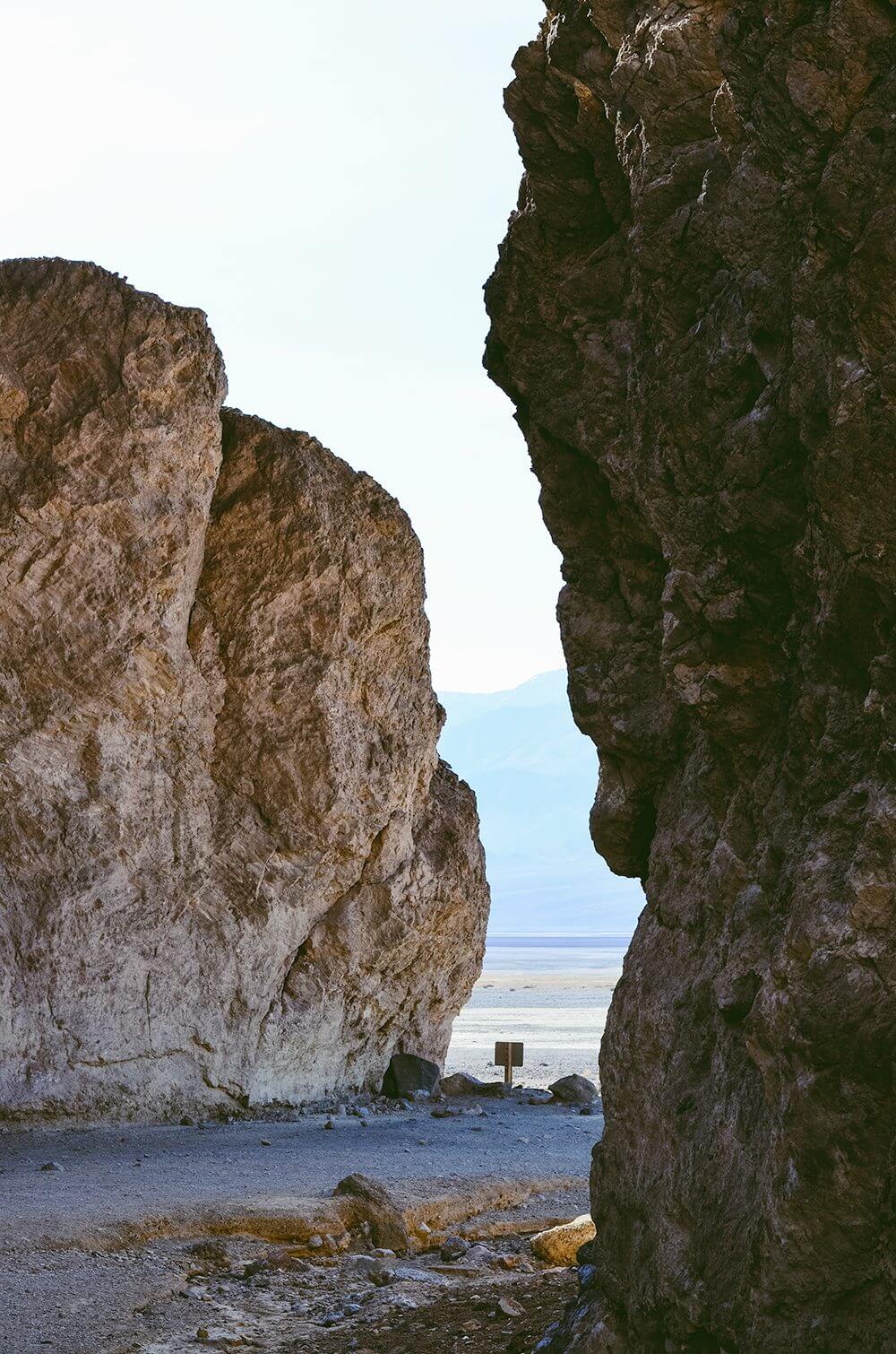
After that we turned south toward Badwater Basin (again, just because it sounded cool). Along the way we saw a sign for Natural Bridge, which also sounded too good to pass up. It turned out to be a fairly easy 1-mile hike (with just a slight incline an intermittent shade) up to the natural bridge formation. This trail keeps going toward Golden Canyon, but we didn’t venture that far. The slow speed of my pregnant-lady pace and our short exploration time encouraged us to get back on the road quickly.


We were greeted to a spectacular view of the salt flats from the Natural Bridge trailhead – a view we didn’t actually notice until we were on the way out! We also ran into a fellow traveler who recommended that we make time for Artist’s Canyon. She said it was so good that she had driven through it twice!

Our next stop was Badwater Basin – a massive salt flat situated 282 feet below sea level. We jokingly sent this photo to my uncle and aunt who are peak-baggers (meaning they get a kick out of climbing the highest peak in every state). We explained that they could keep the peaks, we’ll be basin-baggers instead.


This place was really, really cool. I had never been to a salt flat before, so that in itself was a bit of a novelty. The surface of the flats is coated in salt, giving it a slippery consistency similar to walking on well-packed snow. As we hiked further and further onto the flat we began to see crystal formations forming up along the sides of the path. These formations reform whenever it rains or there is a change in humidity, so the hike never looks exactly the same twice.


One thing I noticed about Death Valley at this point in the trip was how deceptive distances appear there. There is actually a five mile distance between the parking lot and the far end of the salt flat. The tiny dots you see in the distance (fellow hikers) seem like they are just a short walk away when really, they are pretty far out!
After our trek out onto the salt flats we were lucky enough to be gifted a map by some fellow travelers. We had asked the pair of photographers if we could take a quick photo of their map with our phones, but they ended up having an extra! Armed with some vital information, we took a few minutes to plot out our route for the rest of the day.

We hopped in the car and doubled-back toward the center of the park. On the way, we took our new friend’s advice and drove through Artist’s Canyon. This ended up being one of my favorite spots of the day. The rocks here look almost like they have been painted due to the heavy presence of naturally colored minerals. The result is a breathtaking and surreal drive through a multicolored landscape of rocky outcroppings and curvy roadways.

The big attraction is The Artist’s Palette. This particular rock formation showcases multiple colors in one gorgeous scene. Photos are fun, but as always, the real thing was better. This is a must-see for anyone visiting Death Valley National Park.

Our last major stop for the day was the Mesquite Flat Sand Dunes located a little further north in the park. This landscape was strikingly different from the others that we had explored that day, and ended up being a really fun way to finish up our supply of daylight. These huge sandy hills are reminiscent of the deserts I imagined as a kid. Scott kept making Space Balls jokes as we trudged along, chanting “room service, room service” up and down the dunes.

I was super jealous that these people had the foresight to bring along sleds. The kids were howling with joy as they slid down the dunes. We were told that sunrise and sunset are popular times for impromptu yoga sessions too, which makes perfect sense. I would love to get down with some yoga in such a scenic spot.

We hit up Stovepipe Wells after seeing the dunes. This tiny little town offers a gift shop, lodge, and restaurant, all of which are as old and gritty as you might expect (in a good way). We grabbed a bite and then headed back to Vegas. Or at least, that was the plan. Scott decided it would be fun to drive up to Dante’s View as the sun was setting, so that’s what we did. By the time we reached the top (5475 feet) it was well beyond dusk. We couldn’t see much of the land, but the sky was awfully nice.
We spent our last moments in Death Valley quietly observing the fading colors of sunset, then barreled down the curvy mountain roads in pitch darkness – my husband giggling at my shrieks and squeaks all along the way.

All in all, it was a great trip. If we’d had more time I would have loved to check out the Ubebe Crater, the Devil’s Golf Course, and at least one of those mountains! As for the time of year, I think we hit that just right. While the sun was still a little intense, it wasn’t hot at all in Death Valley for our January weekend. I am sure that this is a very different experience in July!
Want more travel stories? Check out our other national park trips: Big Bend, and Grand Canyon.